I will publish the whole available series of the next few weeks. Excellent info. My mom is going to be very disappointed about Elvis....
Part two

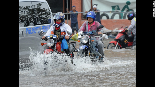
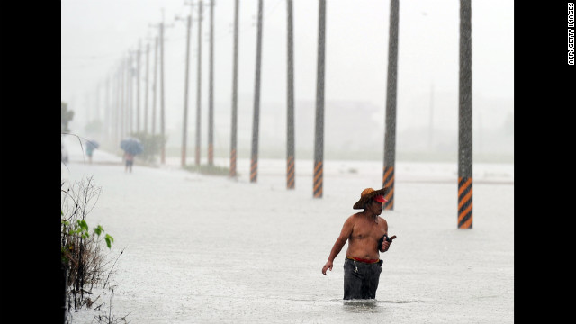 Taiwan residents wade in floodwaters in Wuche, in eastern Ilan County, as typhoon Saola approches the island's east coast on Thursday, August 2. The typhoon dropped as much as 1.5 feet of rain in parts of the Philippines before making landfall in Taiwan on Thursday.
Photos: Typhoon Saola batters the Philippines, Taiwan
Taiwan residents wade in floodwaters in Wuche, in eastern Ilan County, as typhoon Saola approches the island's east coast on Thursday, August 2. The typhoon dropped as much as 1.5 feet of rain in parts of the Philippines before making landfall in Taiwan on Thursday.
Photos: Typhoon Saola batters the Philippines, Taiwan Sinkhole almost swallows car
  Man dies after falling in sinkhole
 Typhoon Saola batters Taiwan


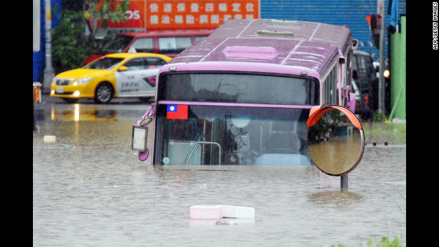 A bus sits half submerged on a flooded road in New Taipei City.
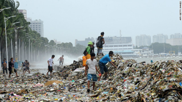
 People collect recyclable material from debris washed ashore in Manila on Wednesday, August 1, after heavy rain from Typhoon Saola.
 People wade through a flooded street Wednesday in Navotas, a Manila suburb.
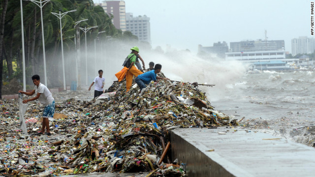
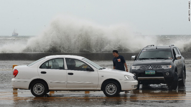 High waves splash up Wednesday along Toxas Boulevard, the famous roadway that runs along Manila Bay.
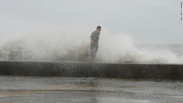 A man braves high waves along Manila's Roxas Boulevard on Wednesday.
 Residents maneuver through a flooded street Wednesday in Navotas.
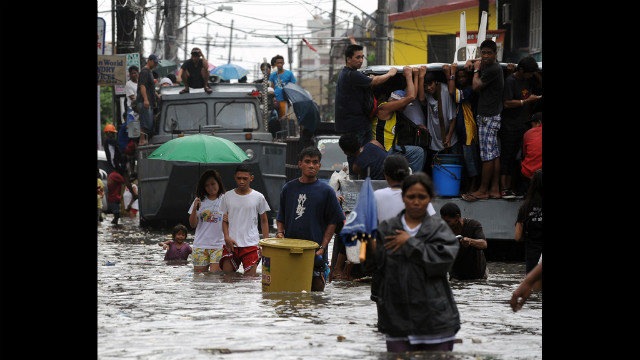
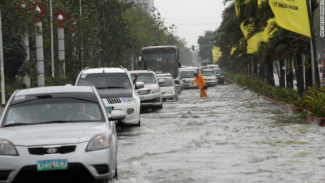
 Motorists make their way through Manila's flooded streets Wednesday.
 Locals pick through debris from the typhoon along Manila's Roxas Boulevard.
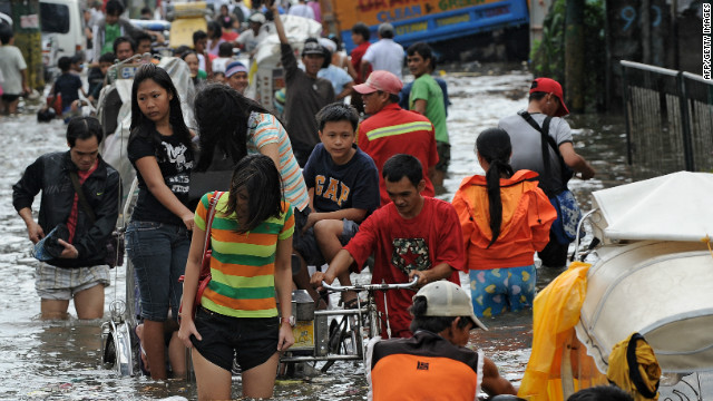
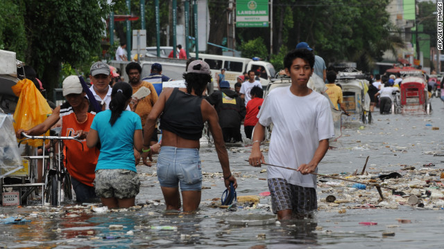 Residents wade through a flooded street filled with trash in Navotas.
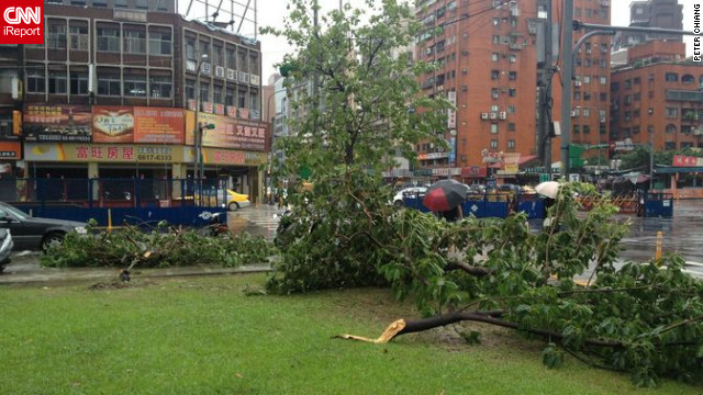 CNN iReporter Peter Chiang captured this image of uprooted trees after Typhoon Saola swept through Taiwan's capital. "Trees are uprooted everywhere here. Apart from that, in Taipei City it's largely fine, but outside the city there's a lot of flooding," Chiang said.
 Motorists drive through floodwaters along Manila's Roxas Boulevard in Manila on Wednesday.
 People pick up recyclable materials among the trash washed ashore along's Manila's Roxas Boulevard.
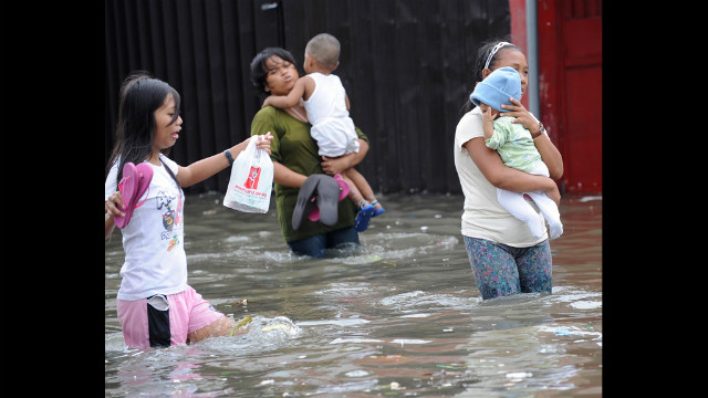
 Residents wade through a flooded street in Navotas in suburban Manila. Forty-four evacuation centers have been opened due to flooding.
 A resident rides in a banca on a flooded street in Navotas.
 A man cleans his house in Taiwan's eastern Yilan County as Typhoon Saola approaches the island's east coast Thursday.
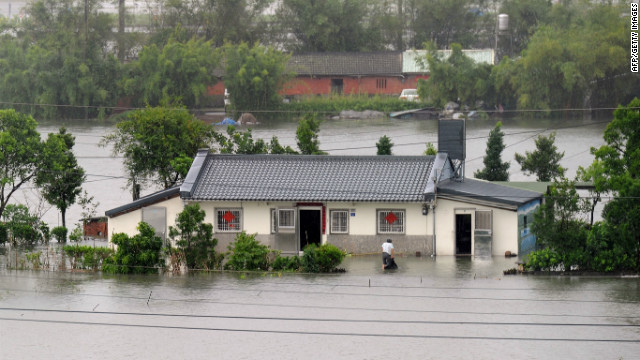
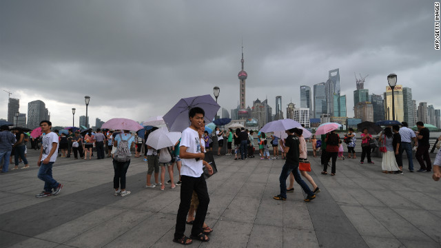 People walk along the Shanghai Bund on Thursday as storm clouds gather over the Huangpu River. The typhoon was expected to strike south of Shanghai later Thursday.


By The Associated Press